
GeoMedia
Scope & Guideline
Empowering Research through Open Access Geospatial Insights
Introduction
Aims and Scopes
- Geospatial Data Utilization:
Research centered on the application of geospatial data and technologies, including satellite imagery, LIDAR, and GIS, for understanding and managing various geographic phenomena. - Urban and Regional Planning:
Exploration of urban digital twins, smart cities, and the role of local authorities in planning and sustainability initiatives. - Cultural Heritage and Environmental Monitoring:
Focus on the protection and management of cultural heritage sites using advanced technologies, including remote sensing and drones. - Sustainable Development and Resilience:
Studies addressing sustainability challenges through innovative solutions in energy management and urban resilience. - Innovation in Geomatics:
Investigation of new technologies and methodologies in geomatics, including AI integration, autonomous systems, and their implications for various industries.
Trending and Emerging
- Digital Twins and Smart Cities:
There is an increasing focus on the concept of digital twins, particularly in urban settings, as cities strive for smarter, more data-driven decision-making processes. - Sustainable Practices in Geomatics:
Emerging themes emphasize sustainability, particularly the role of geomatics in environmental monitoring, energy management, and disaster resilience. - Integration of AI and Geomatics:
The integration of artificial intelligence with geomatics is a growing trend, enhancing data analysis, automation, and predictive modeling capabilities. - Remote Sensing for Disaster Management:
Research is increasingly highlighting the use of remote sensing technologies for monitoring and managing natural disasters, reflecting a timely response to global climate challenges. - Community Engagement through Geographic Technologies:
There is a trend towards utilizing geographic technologies for community engagement and participatory planning, emphasizing the role of local authorities and citizens in decision-making.
Declining or Waning
- Traditional Surveying Techniques:
There is a noticeable decline in publications focused on conventional surveying methods, likely due to the rise of advanced technologies such as drones and autonomous systems that offer more efficient alternatives. - General Geographic Platforms:
The emphasis on general geographic platforms appears to be waning, possibly replaced by more specialized applications that cater to specific industries or research areas. - Static Data Analysis:
Research centered around static data analysis is becoming less prominent, with a shift towards dynamic data utilization and real-time monitoring solutions. - Basic GIS Applications:
The journal has seen fewer contributions focused on basic GIS applications, as the field moves towards more complex integrations of GIS with AI and machine learning.
Similar Journals
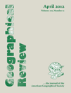
GEOGRAPHICAL REVIEW
Unveiling Insights into Earth's Surface DynamicsGEOGRAPHICAL REVIEW, published by Taylor & Francis Inc, is a premier academic journal recognized for its influential contributions to the fields of geography and earth-surface processes. With an ISSN of 0016-7428 and an E-ISSN of 1931-0846, this journal has established itself as a vital resource for researchers, professionals, and students alike. The journal maintains a strong reputation with a Q1 ranking in both Earth-Surface Processes and Geography, Planning and Development, reflecting its scholarly impact and relevance in the academic community. Additionally, it holds a notable position in Scopus rankings, placing #181 out of 821 in Social Sciences and #45 out of 179 in Earth and Planetary Sciences. Although it is not open access, the GEOGRAPHICAL REVIEW remains essential for those seeking to expand their understanding of spatial analysis and environmental processes from its historical inception in 1969 to its ongoing publications through 2024. Explore rigorous research articles, critical reviews, and innovative studies that shape the discourse in geography and earth sciences today.

South African Journal of Geomatics
Innovating Mapping Technologies for Global ImpactSouth African Journal of Geomatics is a pivotal platform dedicated to the advancement of geomatics, focusing on the dynamic intersection of geographic information science, surveying, and mapping technologies. Published by CONSAS CONFERENCE, the journal serves as a crucial resource for researchers, professionals, and students in the geomatics field, providing insightful, peer-reviewed articles that explore contemporary challenges and innovations. Operating under an open-access model, the journal ensures the wide dissemination of knowledge, promoting collaboration and scholarly exchange among the global geomatics community. With a commitment to enhancing the visibility of significant research and fostering academic discourse, the South African Journal of Geomatics plays a vital role in contributing to the development of this essential discipline in South Africa and beyond.

ISPRS International Journal of Geo-Information
Connecting insights, shaping the future of geoinformation.ISPRS International Journal of Geo-Information, published by MDPI, stands at the forefront of the field of geospatial sciences, contributing valuable knowledge and research insights since its inception in 2012. This open access journal, which boasts an impressive collection of articles that emphasize the integration of geographic information systems (GIS) in Earth and planetary sciences, currently achieves a remarkable standing, with a 2023 impact factor ranking in the Q1 category for both Earth and Planetary Sciences and Geography, Planning and Development. Researchers and professionals engaged in the study of spatial data, remote sensing, and innovative geoinformation technologies will find the journal an essential resource, offering diverse perspectives and methodologies. With its open access model, the journal aims to promote the dissemination of knowledge globally, fostering collaboration among scholars while pushing the boundaries of research in geoinformation disciplines. The journal is based in Switzerland and is well-positioned to contribute significantly to the understanding and application of geospatial data for societal advancements.
Journal of Spatial Science
Transforming Understanding of Our Spatial WorldThe Journal of Spatial Science, published by Taylor & Francis Ltd, serves as a prominent platform for the dissemination of research in the interdisciplinary fields of geography, atmospheric science, and energy. With an ISSN of 1449-8596 and an E-ISSN of 1836-5655, this journal has established itself as a vital resource since its inception in 2004, boasting an impressive convergence period extending to 2024. Recognized in the Q3 quartile for Atmospheric Science and Energy (miscellaneous), and achieving a Q2 classification in Geography, Planning and Development in 2023, the journal not only reflects the evolving complexities of spatial science but also underscores its increasing relevance in addressing contemporary global challenges. The journal holds a commendable position in Scopus rankings, with notable placements in various categories, further highlighting its academic significance. Researchers, professionals, and students are encouraged to engage with the rich content offered, as the Journal of Spatial Science remains committed to advancing knowledge and fostering discussions pertinent to spatial analysis and its applications.

International Journal of Spatial Data Infrastructures Research
Transforming Spatial Data into Actionable InsightsThe International Journal of Spatial Data Infrastructures Research is a prestigious, open-access publication dedicated to advancing knowledge in the field of spatial data infrastructures. Published by the European Commission, Joint Research Centre, this journal has been a vital resource since its inception in 2006, promoting innovative research that informs policy and practice in geographic information systems and spatial data management. With a robust commitment to open access, the journal ensures that critical findings are readily available to researchers, professionals, and students globally, fostering a collaborative environment for the development of spatial technologies. The journal's unique focus on spatial data infrastructures makes it an essential platform for sharing empirical studies, theoretical advancements, and practical applications, ultimately driving the evolution of smart, sustainable geospatial solutions.
Estudios Geograficos
Fostering Interdisciplinary Dialogue in GeographyEstudios Geograficos, a prominent journal published by the CONSEJO SUPERIOR INVESTIGACIONES CIENTIFICAS-CSIC in Spain, serves as a vital platform for advancing the fields of geography and earth-surface processes. With an ISSN of 0014-1496 and E-ISSN of 1988-8546, the journal has been committed to Open Access since 1996, ensuring that its valuable research is accessible to a global audience. Recognized as a Q3 journal in both Earth-Surface Processes and Geography, Planning and Development, it plays a crucial role in shaping understanding and policy related to our planet. As of 2023, it holds a respectable rank of 562nd in Social Sciences Geography and maintains a percentile standing, reflecting its significance within the academic community. Covering a diverse range of topics, Estudios Geograficos aims to foster scholarly dialogue and disseminate innovative interdisciplinary findings, providing researchers, professionals, and students with critical insights and tools to address contemporary geographic challenges.
International Journal of E-Planning Research
Shaping Tomorrow's Cities with E-Planning InnovationsThe International Journal of E-Planning Research (ISSN: 2160-9918, E-ISSN: 2160-9926) is a premier academic platform published by IGI GLOBAL, dedicated to the intersection of technology and urban planning. Established to provide an avenue for innovative research from 2017 to 2024, this journal sits in the esteemed Q2 quartile for both Computer Science Applications and Geography, Planning and Development, while achieving a prestigious Q1 ranking in Urban Studies for 2023. The journal is recognized for its contribution to the academic landscape, evidenced by its Scopus rankings, which place it in the top echelons of social sciences research, particularly in urban studies (Rank #33/279) and geography (Rank #115/821). It serves as an essential resource for researchers, professionals, and students seeking to explore the evolving role of digital technologies and e-planning methods in shaping urban environments. With a focus on quality and relevance, this journal is committed to advancing the discourse on how e-planning can influence urban development and sustainability.

Journal of Regional and City Planning
Fostering sustainable development through collaborative research.Journal of Regional and City Planning, published by ITB JOURNAL PUBL, is a pivotal platform dedicated to advancing research in the fields of urban studies, geography, and development. Established in Indonesia, this esteemed journal (ISSN: 2502-6429) serves as an integrative forum for scholars, professionals, and students to explore the complex dynamics of regional and city planning within the context of rapidly changing urban environments. With a commendable Scopus ranking that places it in the Q3 category for Development and Geography and Q2 for Urban Studies, the journal emphasizes quality scholarship aimed at informing policy and practice between 2017 and 2024. Although currently not available in open access, it maintains a solid reputation for its rigorous peer-reviewed articles that contribute significantly to the academic discourse and practical frameworks in urban and regional development. Its commitment to fostering dialogue on sustainable development makes it a vital resource for anyone involved in planning and policy-making.
Annals of GIS
Elevating Understanding Through Spatial AnalysisWelcome to the Annals of GIS, a leading academic journal published by Taylor & Francis Ltd, dedicated to advancing the field of Geographic Information Science and its applications. With an ISSN of 1947-5683 and an E-ISSN of 1947-5691, this Open Access journal has been ensuring wide accessibility since 2019, thereby bolstering the dissemination of knowledge in areas such as remote sensing, spatial analysis, and geoinformatics. Hailing from the United Kingdom, the journal ranks impressively within its categories, achieving a Q2 status in Computer Science Applications and a prestigious Q1 ranking in Earth and Planetary Sciences for 2023, placing it in the top 10% among its peers. With a focus on innovative research spanning from 2009 to 2024, the Annals of GIS serves as a vital platform for researchers, professionals, and students alike, providing insights and fostering discussions that push the boundaries of geographic technologies and their real-world applications.

Geomatik
Navigating the complexities of our environment through geomatics.Geomatik is a pioneering open-access journal dedicated to advancing the field of geomatics, encompassing disciplines such as geospatial data analysis, remote sensing, and geographic information systems. Founded in 2016 by the esteemed Geomatik Journal publisher, this peer-reviewed platform aims to disseminate high-quality research and innovative methodologies to a global audience. With its E-ISSN 2564-6761, Geomatik facilitates accessibility to cutting-edge studies that address vital challenges in environment monitoring, urban planning, and spatial data management. The journal not only encourages collaboration among researchers and practitioners but also serves as an essential resource for students seeking to deepen their understanding of geomatic sciences. Its commitment to open access fosters scholarly exchange and enhances visibility for authors, contributing to significant advancements within the geomatics community.