
International Journal of Applied Earth Observation and Geoinformation
Scope & Guideline
Navigating the Future of Geoinformation and Sustainability.
Introduction
Aims and Scopes
- Remote Sensing Applications:
The journal emphasizes the use of remote sensing technologies for monitoring environmental changes, land use, and natural resources. Papers often explore applications in agriculture, forestry, water management, and disaster response. - Geospatial Data Integration:
Research published in this journal frequently integrates various data sources, including satellite imagery, UAV data, and ground-based observations, to enhance spatial analysis and improve the accuracy of environmental assessments. - Machine Learning and AI in Geospatial Analysis:
The journal highlights the application of machine learning and artificial intelligence techniques to extract meaningful insights from complex geospatial datasets, facilitating advancements in predictive modeling and automated classification. - Sustainable Development and Environmental Monitoring:
A core aim of the journal is to support sustainable development initiatives through the application of geoinformation technologies in environmental monitoring, assessing climate change impacts, and managing natural resources. - Innovative Methodologies and Tools:
The journal promotes the development and application of novel methodologies and tools for data processing, analysis, and visualization in the context of earth observation and geoinformation.
Trending and Emerging
- Deep Learning and AI Techniques:
There is a marked increase in research utilizing deep learning and AI techniques for geospatial data analysis, including applications in image classification, anomaly detection, and predictive modeling, highlighting the integration of advanced computational methods. - Multi-Modal and Multi-Scale Approaches:
Emerging trends indicate a growing interest in multi-modal and multi-scale analyses that combine different types of data (e.g., satellite, UAV, ground-based) to improve the accuracy and robustness of environmental assessments. - Climate Change Impact Studies:
Research focusing on the impacts of climate change on various ecosystems and socio-economic systems is on the rise, with studies utilizing remote sensing data to monitor changes and inform adaptation strategies. - Real-Time Monitoring and Big Data Analytics:
The journal is increasingly publishing studies that emphasize real-time monitoring of environmental changes using big data analytics and cloud computing technologies, reflecting the need for timely data in decision-making. - Community and Citizen Science Integrations:
There is a growing trend towards integrating community and citizen science data with traditional remote sensing approaches, enhancing data collection efforts and fostering public engagement in environmental monitoring.
Declining or Waning
- Traditional Land Cover Mapping:
There has been a noticeable decline in papers focusing on conventional land cover mapping techniques, as researchers increasingly adopt advanced methods such as machine learning and deep learning for more accurate and automated classifications. - Static Environmental Assessments:
Research centered around static assessments of environmental conditions is becoming less prominent. The journal is moving towards dynamic monitoring approaches that emphasize real-time data collection and analysis. - Single-Source Remote Sensing Studies:
Papers that rely solely on single-source remote sensing data are appearing less frequently, as the integration of multi-source data (e.g., combining optical and radar data) is being prioritized for more comprehensive analyses. - Basic GIS Applications:
There is a diminishing emphasis on basic GIS applications without advanced analytical frameworks, as the field increasingly requires complex analyses and modeling to address contemporary environmental challenges. - Generalized Environmental Models:
Research that presents generalized environmental models without considering local contexts and specific case studies is less common, with a growing preference for studies that address localized issues through targeted approaches.
Similar Journals

South African Journal of Geomatics
Connecting Scholars and Professionals in GeomaticsSouth African Journal of Geomatics is a pivotal platform dedicated to the advancement of geomatics, focusing on the dynamic intersection of geographic information science, surveying, and mapping technologies. Published by CONSAS CONFERENCE, the journal serves as a crucial resource for researchers, professionals, and students in the geomatics field, providing insightful, peer-reviewed articles that explore contemporary challenges and innovations. Operating under an open-access model, the journal ensures the wide dissemination of knowledge, promoting collaboration and scholarly exchange among the global geomatics community. With a commitment to enhancing the visibility of significant research and fostering academic discourse, the South African Journal of Geomatics plays a vital role in contributing to the development of this essential discipline in South Africa and beyond.
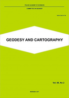
Geodesy and Cartography
Empowering Collaboration in Geospatial SciencesGeodesy and Cartography, published by the Polska Akademia Nauk (Polish Academy of Sciences), is a premier open-access journal dedicated to advancing the fields of geodesy, cartography, and geographic information science. Since its inception in 2010, the journal has provided a vital platform for researchers, professionals, and students to share their findings, fostering innovation and collaboration in these critical areas of study. With its ISSN 2080-6736 and E-ISSN 2300-2581, the journal is accessible to a global audience, ensuring that cutting-edge research is readily available to enhance scientific understanding and application. The journal not only serves as a repository of knowledge but also aims to contribute to the development of best practices and methodologies within geospatial sciences, making it an essential resource for anyone invested in the ever-evolving landscape of mapping and spatial data analysis.
Transactions in GIS
Innovating Methodologies for Earth and Planetary SciencesTransactions in GIS is a premier academic journal published by WILEY, dedicated to advancing the field of Geographic Information Science (GIS). With an ISSN of 1361-1682 and an E-ISSN of 1467-9671, this journal has continually contributed valuable insights since its inception in 1996, transforming the landscape of GIS research and application. Covering a broad scope within Earth and Planetary Sciences, it holds a notable Q2 ranking and stands in the 74th percentile among its peers as per Scopus rankings. The journal serves as a critical platform for researchers, professionals, and students who seek to disseminate and engage with innovative GIS methodologies, applications, and theoretical advancements. With a commitment to quality and rigor, Transactions in GIS remains a vital resource for those at the forefront of geographic research and analysis.
Annals of GIS
Pioneering Discoveries in Geographic Information ScienceWelcome to the Annals of GIS, a leading academic journal published by Taylor & Francis Ltd, dedicated to advancing the field of Geographic Information Science and its applications. With an ISSN of 1947-5683 and an E-ISSN of 1947-5691, this Open Access journal has been ensuring wide accessibility since 2019, thereby bolstering the dissemination of knowledge in areas such as remote sensing, spatial analysis, and geoinformatics. Hailing from the United Kingdom, the journal ranks impressively within its categories, achieving a Q2 status in Computer Science Applications and a prestigious Q1 ranking in Earth and Planetary Sciences for 2023, placing it in the top 10% among its peers. With a focus on innovative research spanning from 2009 to 2024, the Annals of GIS serves as a vital platform for researchers, professionals, and students alike, providing insights and fostering discussions that push the boundaries of geographic technologies and their real-world applications.
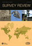
SURVEY REVIEW
Empowering Researchers with Vital Findings in Diverse FieldsSURVEY REVIEW is a distinguished journal published by Taylor & Francis Ltd, focusing on a diverse range of disciplines including Civil and Structural Engineering, Computers in Earth Sciences, and Earth and Planetary Sciences. With an ISSN of 0039-6265 and an E-ISSN of 1752-2706, this journal has been a vital resource for scholarly communication since its inception in 1963. Positioned within the Q2 and Q3 quartile categories according to the latest rankings, it is recognized for its significant contributions to advancing knowledge in multiple fields, specifically holding a rank of 64/159 in Earth and Planetary Sciences and 32/73 in Computers in Earth Sciences. Researchers, professionals, and students benefit from its critical insights into complex engineering and scientific challenges. Although SURVEY REVIEW is not open access, it remains a highly cited journal, making it an essential avenue for disseminating pivotal findings that impact both academia and industry practices.

GEOINFORMATICA
Leading the Way in High-Impact Geoinformatics ResearchGEOINFORMATICA is a leading journal in the field of geoinformatics, widely recognized for its contributions to both Geography, Planning and Development as well as Information Systems. Published by Springer, this journal holds a distinguished Q1 ranking in Geography and a Q2 ranking in Information Systems as of 2023, reflecting its high-impact research contributions and authoritative voice in these disciplines. Since its inception in 1997, GEOINFORMATICA has provided a platform for innovative research, methodologies, and applications related to geographic information science, spatial data analysis, and remote sensing technologies. The journal's rigorous peer-review process and strategic positioning within the academic landscape allow it to attract a diverse array of publications, assisting researchers, professionals, and students in understanding complex spatial phenomena. While the journal does not offer Open Access, it remains a vital resource located in the Netherlands, and its indexed status has secured impressive Scopus rankings—#131 in Geography, Planning and Development, and #134 in Information Systems, showcasing its robust scholarly influence. Explore the latest developments and cutting-edge research through GEOINFORMATICA, where scholarly excellence converges with real-world relevance.

Remote Sensing
Advancing Knowledge in Earth and Planetary SciencesRemote Sensing is a highly esteemed journal published by MDPI, dedicated to the domain of Earth and Planetary Sciences. With an impressive impact factor reflected in its rank of #16 out of 195 in the general Earth and Planetary Sciences category, this journal achieves a commendable 92nd percentile among its peers, indicating its significant contribution to the field. Since its inception in 2009 as an Open Access journal, it has enabled researchers, professionals, and students from around the globe to access high-quality, peer-reviewed articles that delve into the latest advancements in remote sensing technologies, methodologies, and applications. Based in Switzerland, Remote Sensing serves as a vital platform for disseminating innovative research that supports and enhances our understanding of Earth's processes and environments, ensuring scientific knowledge remains freely accessible and impactful.
International Journal of Digital Earth
Exploring the intersection of Earth and technology.Welcome to the International Journal of Digital Earth, a premier open-access journal published by Taylor & Francis Ltd, dedicated to advancing the field of digital geoscience. With its ISSN 1753-8947 and E-ISSN 1753-8955, this journal has established itself as a vital resource for scholars and practitioners alike since its inception in 2008. The journal is at the forefront of interdisciplinary research, showcasing a diverse scope from Earth sciences to computer science applications, evidenced by its impressive ranking in the 2023 Scopus database. It holds a Q1 categorization in Earth and Planetary Sciences, with a percentile rank among the top 16% of its peers, and also stands out in the Q2 quartile for both Computer Science Applications and Software disciplines. The journal's commitment to open access, established in 2022, underscores its dedication to disseminating knowledge and fostering collaboration. By providing a platform for high-quality research, the International Journal of Digital Earth plays a critical role in addressing the complexities of our changing planet through innovative digital solutions. Whether you are an experienced researcher or a student, this journal is an essential addition to your academic toolkit.

Geo-Spatial Information Science
Pioneering Research at the Crossroads of Geography and ComputingGeo-Spatial Information Science, published by TAYLOR & FRANCIS LTD, is a premier open-access journal that has been at the forefront of disseminating cutting-edge research since its inception in 1998. With an ISSN of 1009-5020 and an E-ISSN of 1993-5153, this journal plays a pivotal role in the fields of Computers in Earth Sciences and Geography, Planning and Development, achieving a prestigious Q1 ranking in both categories as of 2023. Its exemplary Scopus rankings highlight its relevance within the social sciences and earth sciences, placing it among the top echelons of its field, with a 95th and 93rd percentile respectively. The journal aims to bridge the gap between innovative geospatial technologies and their applications in real-world scenarios, fostering interdisciplinary collaboration and advancing the global understanding of spatial data analysis. Based in the United Kingdom, Geo-Spatial Information Science invites researchers, professionals, and students to contribute and access research that shapes the future of geo-spatial sciences, all while adhering to open access principles that ensure broad dissemination and engagement with the broader academic community.

Geomatik
Empowering research through open access in geomatics.Geomatik is a pioneering open-access journal dedicated to advancing the field of geomatics, encompassing disciplines such as geospatial data analysis, remote sensing, and geographic information systems. Founded in 2016 by the esteemed Geomatik Journal publisher, this peer-reviewed platform aims to disseminate high-quality research and innovative methodologies to a global audience. With its E-ISSN 2564-6761, Geomatik facilitates accessibility to cutting-edge studies that address vital challenges in environment monitoring, urban planning, and spatial data management. The journal not only encourages collaboration among researchers and practitioners but also serves as an essential resource for students seeking to deepen their understanding of geomatic sciences. Its commitment to open access fosters scholarly exchange and enhances visibility for authors, contributing to significant advancements within the geomatics community.