International Journal of Spatial Data Infrastructures Research
Scope & Guideline
Empowering Research Through Open Access Innovation
Introduction
Aims and Scopes
- Development and Management of Spatial Data Infrastructures:
Research related to the design, implementation, and management of spatial data infrastructures, including best practices and case studies from various regions. - Integration of Geospatial Technologies:
Exploring the integration of various geospatial technologies, such as GIS, remote sensing, and spatial databases, in enhancing the effectiveness of SDIs. - Policy and Governance Issues in SDIs:
Examination of the policies, legal frameworks, and governance structures that influence the development and utilization of spatial data infrastructures. - User Engagement and Community Participation:
Studies focusing on how communities and end-users engage with spatial data infrastructures, including participatory approaches and user-centered design. - Innovative Applications of Spatial Data:
Research on novel applications of spatial data in diverse fields, such as urban planning, environmental monitoring, and disaster management.
Trending and Emerging
- Smart Cities and Urban Analytics:
An increasing number of studies are exploring the role of spatial data infrastructures in the development of smart cities, focusing on urban analytics and data-driven decision-making. - Spatial Data Sharing and Interoperability:
There is a growing emphasis on the importance of data sharing and interoperability among different SDI systems, highlighting collaborative frameworks and standards. - Impact of Big Data on Spatial Analysis:
Research is increasingly addressing the implications of big data for spatial analysis, including how to manage and analyze vast datasets within SDIs. - Climate Change and Environmental Sustainability:
Emerging studies are focusing on the application of spatial data infrastructures in addressing climate change and promoting environmental sustainability, reflecting global priorities. - Citizen Science and Volunteered Geographic Information (VGI):
There is a trend towards investigating the contributions of citizen science and VGI in the context of spatial data infrastructures, emphasizing community engagement and democratization of data.
Declining or Waning
- Traditional Mapping Techniques:
Research focusing solely on traditional mapping methods is becoming less prominent as the field shifts towards more advanced geospatial technologies and methodologies. - Static Data Models:
There is a noticeable decline in studies emphasizing static data models, as the focus is increasingly on dynamic and real-time data integration within SDIs. - Localized Case Studies:
The journal has seen fewer localized case studies, indicating a shift towards broader, comparative analyses and global perspectives on spatial data infrastructures. - Historical Analysis of SDI Development:
Research concentrating on the historical evolution of spatial data infrastructures is becoming less common, as contemporary and future-oriented studies gain more traction.
Similar Journals

International Journal of Applied Earth Observation and Geoinformation
Unlocking Geospatial Innovations for a Sustainable Future.International Journal of Applied Earth Observation and Geoinformation is a premier peer-reviewed journal published by Elsevier, focusing on the integration and application of earth observation and geoinformation technologies across diverse fields. With an open access model established in 2020, this journal enhances accessibility and dissemination of research crucial for addressing global challenges related to climate change, resource management, and sustainable development. The journal occupies a notable position within the academic community, featuring a Q1 ranking in multiple categories including Computers in Earth Sciences, Earth-Surface Processes, and Global and Planetary Change, reflecting its significant impact and relevance in these disciplines. It is recognized for its high-quality articles that explore innovative methodologies and applications, making it an essential resource for researchers, practitioners, and students alike who seek to advance their understanding of earth dynamics and geospatial technology. The journal is indexed in Scopus with impressive rankings that underscore its high citation impact and scholarly influence, with an emphasis on providing a platform for the latest findings in management, monitoring, and policy in environmental science.

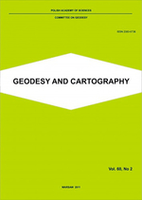
Geodesy and Cartography
Illuminating the Landscape of Geodesy and CartographyGeodesy and Cartography, published by the Polska Akademia Nauk (Polish Academy of Sciences), is a premier open-access journal dedicated to advancing the fields of geodesy, cartography, and geographic information science. Since its inception in 2010, the journal has provided a vital platform for researchers, professionals, and students to share their findings, fostering innovation and collaboration in these critical areas of study. With its ISSN 2080-6736 and E-ISSN 2300-2581, the journal is accessible to a global audience, ensuring that cutting-edge research is readily available to enhance scientific understanding and application. The journal not only serves as a repository of knowledge but also aims to contribute to the development of best practices and methodologies within geospatial sciences, making it an essential resource for anyone invested in the ever-evolving landscape of mapping and spatial data analysis.

Geomatik
Exploring the frontiers of geospatial innovation.Geomatik is a pioneering open-access journal dedicated to advancing the field of geomatics, encompassing disciplines such as geospatial data analysis, remote sensing, and geographic information systems. Founded in 2016 by the esteemed Geomatik Journal publisher, this peer-reviewed platform aims to disseminate high-quality research and innovative methodologies to a global audience. With its E-ISSN 2564-6761, Geomatik facilitates accessibility to cutting-edge studies that address vital challenges in environment monitoring, urban planning, and spatial data management. The journal not only encourages collaboration among researchers and practitioners but also serves as an essential resource for students seeking to deepen their understanding of geomatic sciences. Its commitment to open access fosters scholarly exchange and enhances visibility for authors, contributing to significant advancements within the geomatics community.

Acta Geographica Slovenica-Geografski Zbornik
Exploring cultural landscapes, one study at a time.Acta Geographica Slovenica-Geografski Zbornik is a prominent academic journal published by the Geografski Institut Antona Melika ZRC SAZU, situated in Slovenia. This open-access journal, active since 2003, has made significant strides in the fields of cultural studies, geography, and earth sciences, earning impressive rankings in its respective categories—Q1 in Cultural Studies and Q3 in both Earth and Planetary Sciences and Geography, Planning and Development. With an impactful presence evidenced by its Scopus rankings, including being placed in the 90th percentile for Cultural Studies, Acta Geographica Slovenica serves as an essential platform for researchers, professionals, and students alike, facilitating accessible scholarly dialogue and contributing to the development of geographical and cultural knowledge. The journal is dedicated to advancing research that develops innovative perspectives on geographical phenomena, making it an invaluable resource within the academic community.

South African Journal of Geomatics
Elevating the Discourse in Geographic SciencesSouth African Journal of Geomatics is a pivotal platform dedicated to the advancement of geomatics, focusing on the dynamic intersection of geographic information science, surveying, and mapping technologies. Published by CONSAS CONFERENCE, the journal serves as a crucial resource for researchers, professionals, and students in the geomatics field, providing insightful, peer-reviewed articles that explore contemporary challenges and innovations. Operating under an open-access model, the journal ensures the wide dissemination of knowledge, promoting collaboration and scholarly exchange among the global geomatics community. With a commitment to enhancing the visibility of significant research and fostering academic discourse, the South African Journal of Geomatics plays a vital role in contributing to the development of this essential discipline in South Africa and beyond.

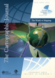
CARTOGRAPHIC JOURNAL
Exploring the Boundaries of Geographic KnowledgeThe Cartographic Journal, published by Taylor & Francis Ltd, stands at the forefront of the field of cartography and geographic information systems. Established in 1964, this quarterly journal has been a pivotal platform, fostering academic discourse and research in Earth-Surface Processes, evidenced by its impressive Q2 ranking and a Scopus status reflecting its relevance in the discipline. With an ISSN of 0008-7041 and an E-ISSN of 1743-2774, the journal circulates a wealth of insights and innovations essential for researchers, professionals, and students devoted to understanding the complexities of geographic representations. While it maintains a traditional subscription model, its integrity and contributions are well-recognized in the UK and globally, supported by a mission to enhance cartographic education and stimulate advancements in spatial data analysis. As it converges its focus through 2024, The Cartographic Journal continues to illuminate the evolving landscapes of geography and cartography, making it an indispensable resource for anyone invested in these dynamic fields.

Revue Internationale de Geomatique
Transforming Spatial Data into Actionable KnowledgeRevue Internationale de Geomatique (ISSN: 1260-5875, E-ISSN: 2116-7060) is a prestigious journal published by TECH SCIENCE PRESS, dedicated to advancing the field of geomatics. This journal serves as a vital platform for disseminating significant research findings, cutting-edge methodologies, and innovative applications within the realm of spatial data and technology. With an emphasis on interdisciplinary studies, it fosters collaboration among researchers, professionals, and students across various domains, including environmental science, urban planning, and geographic information systems (GIS). Although not an open-access journal, Revue Internationale de Geomatique maintains a rigorous peer-review process ensuring the publication of high-quality articles that contribute to the evolving landscape of geomatics. Given its relevance and commitment to scholarly excellence, this journal is a crucial resource for advancing knowledge and practices in the ever-growing field of spatial information science.

SURVEY REVIEW
Empowering Researchers with Vital Findings in Diverse FieldsSURVEY REVIEW is a distinguished journal published by Taylor & Francis Ltd, focusing on a diverse range of disciplines including Civil and Structural Engineering, Computers in Earth Sciences, and Earth and Planetary Sciences. With an ISSN of 0039-6265 and an E-ISSN of 1752-2706, this journal has been a vital resource for scholarly communication since its inception in 1963. Positioned within the Q2 and Q3 quartile categories according to the latest rankings, it is recognized for its significant contributions to advancing knowledge in multiple fields, specifically holding a rank of 64/159 in Earth and Planetary Sciences and 32/73 in Computers in Earth Sciences. Researchers, professionals, and students benefit from its critical insights into complex engineering and scientific challenges. Although SURVEY REVIEW is not open access, it remains a highly cited journal, making it an essential avenue for disseminating pivotal findings that impact both academia and industry practices.

Journal of Spatial Information Science
Fostering Collaboration in Spatial Information ScienceThe Journal of Spatial Information Science is a premier open-access journal published by the University of Maine, dedicated to advancing research in the interdisciplinary fields of spatial information science, geography, and computer science. With an ISSN of 1948-660X, this journal has established itself as a significant contributor to the academic community since its inception in 2010, achieving notable rankings as evidenced by its classification in the Q2 quartile across multiple categories, including Computers in Earth Sciences and Geography. The journal offers a platform for innovative research, fostering collaboration and knowledge dissemination among researchers and practitioners. Its impact is further underscored by its Scopus rankings, placing it in the top percentiles across critical disciplines. With Open Access options available, the Journal of Spatial Information Science ensures that high-quality research is accessible to a broader audience, promoting the ongoing development of the field through thoughtful and rigorous academic inquiry.

GEOGRAPHICAL ANALYSIS
Connecting Research and Application in GeographyGEOGRAPHICAL ANALYSIS, published by WILEY, is a premier scholarly journal that has been at the forefront of geographical and earth-surface research since its inception in 1969. With an ISSN of 0016-7363 and an E-ISSN of 1538-4632, this journal has established itself as an essential resource for researchers and professionals in the fields of Earth-Surface Processes and Geography, Planning and Development, achieving impressive rankings of 13th and 60th in their respective categories according to Scopus, placing it in the Q1 quartile for both. The journal is renowned for its rigorous peer-reviewed articles that contribute valuable insights into spatial analysis, environmental impacts, and urban planning, thus fostering a deeper understanding of geographical phenomena. With access options available through traditional subscriptions, GEOGRAPHICAL ANALYSIS continues to serve as a critical platform for the dissemination of cutting-edge research and innovative methodologies, ultimately shaping the future of geographical inquiry and application.