Remote Sensing in Ecology and Conservation
Scope & Guideline
Exploring the synergy of technology and ecology for a sustainable world.
Introduction
Aims and Scopes
- Remote Sensing Applications in Ecology:
Utilization of various remote sensing technologies, including satellite imagery, UAVs, and LiDAR, to monitor and analyze ecological parameters such as vegetation structure, wildlife populations, and habitat changes. - Biodiversity Monitoring and Conservation:
Studies emphasizing the role of remote sensing in assessing biodiversity, tracking species distribution, and informing conservation strategies through high-resolution imagery and data integration. - Environmental Change Assessment:
Research focused on using remote sensing to detect and quantify environmental changes, such as land use change, climate impacts, and habitat degradation, to support ecological resilience and management. - Innovative Methodologies:
Development and application of advanced methodologies, including machine learning and deep learning techniques, for processing and analyzing remote sensing data to enhance ecological research. - Community Science and Public Engagement:
Exploring the role of community science and citizen engagement in data collection and analysis, particularly using remote sensing and camera traps, to promote conservation efforts.
Trending and Emerging
- Integration of Deep Learning in Remote Sensing:
The increasing application of deep learning techniques for processing remote sensing data is a prominent trend, enhancing the accuracy and efficiency of ecological monitoring and biodiversity assessments. - High-Resolution and Multi-Platform Data Utilization:
Emerging research focuses on the use of high-resolution imagery from various platforms, including satellites and UAVs, to achieve more detailed ecological insights and improve conservation strategies. - Climate Change and Ecological Resilience Studies:
There is a growing emphasis on understanding the impacts of climate change on ecosystems through remote sensing, with studies investigating resilience and adaptation strategies across diverse habitats. - Community Science and Citizen Engagement:
The role of community science in data collection and ecological monitoring is gaining traction, with studies exploring how citizen involvement can enhance the effectiveness of conservation efforts using remote sensing. - Spatial Ecology and Landscape Connectivity:
Research exploring spatial patterns of biodiversity and habitat connectivity is on the rise, utilizing remote sensing to understand ecological dynamics and inform landscape management.
Declining or Waning
- Traditional Ground-Based Monitoring:
There has been a noticeable decrease in studies relying solely on traditional ground-based ecological monitoring methods, as remote sensing technologies increasingly provide more efficient and expansive data collection alternatives. - Basic Ecological Surveys without Remote Sensing Integration:
Research focusing on basic ecological surveys that do not utilize remote sensing or technology integration is becoming less common, reflecting a trend towards more technologically advanced methodologies. - Limited Use of Non-Spatial Data:
Studies that rely primarily on non-spatial data for ecological assessments are declining, as the emphasis shifts towards spatially explicit analyses that leverage remote sensing capabilities. - Generalized Species Distribution Models:
There is a waning interest in simplistic species distribution models that do not incorporate remote sensing data, as researchers seek more complex and data-rich models that account for environmental variables.
Similar Journals

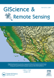
GIScience & Remote Sensing
Pioneering Insights in Earth and Planetary SciencesGIScience & Remote Sensing, published by Taylor & Francis Ltd, stands as a leading journal in the realm of Earth and Planetary Sciences, holding a prestigious Q1 ranking. Since its transition to Open Access in 2022, the journal has significantly broadened its reach, enabling researchers, professionals, and students across the globe to disseminate and access cutting-edge research related to geographic information science and remote sensing technologies. With a focus on publishing high-quality, peer-reviewed articles that contribute to the understanding of the Earth’s processes, environments, and interactions, this journal not only supports advancements in scientific knowledge but also fosters interdisciplinary collaboration. Based in the United Kingdom, GIScience & Remote Sensing continues to pave the way for innovative methodologies and applications, solidifying its vital role within the scientific community.

MARINE AND FRESHWATER RESEARCH
Pioneering insights into aquatic ecology and sustainability.Marine and Freshwater Research is a prestigious journal published by CSIRO PUBLISHING that serves as a key platform for the dissemination of cutting-edge research in the fields of Aquatic Science, Ecology, and Oceanography. With an impactful presence since its inception in 1948, the journal provides critical insights into the dynamics of freshwater and marine ecosystems, promoting interdisciplinary approaches that contribute to our understanding of biodiversity and sustainability. Currently ranked in the Q2 category across major scientific domains, including Ecology and Aquatic Science, it enjoys a robust academic reputation supported by impressive Scopus rankings, such as Rank #66/247 in Aquatic Science and Rank #44/145 in Oceanography, reflecting its high citation impact and relevance. While offering a subscription-based access model, the journal remains dedicated to fostering dialogue and innovation within the scientific community, aiming to bridge the gap between research findings and practical applications in environmental management. Located in Australia, Marine and Freshwater Research is an essential resource for researchers, professionals, and students dedicated to exploring the complexities of aquatic ecosystems and advocating for their preservation.

Remote Sensing Applications-Society and Environment
Empowering research that reshapes our understanding of the Earth.Remote Sensing Applications-Society and Environment, published by Elsevier, stands at the forefront of interdisciplinary research, bridging the fields of remote sensing and environmental science. With an impressive impact factor and recognition within the Q1 quartile in both Computers in Earth Sciences and Geography, Planning and Development, the journal is a vital resource for researchers, professionals, and students committed to advancing our understanding of environmental dynamics through innovative remote sensing technologies. Since its inception in 2015, this journal has cultivated a rich repository of knowledge, addressing pertinent societal and environmental issues, making it a leading source for transformative applications in the field. Accessible and relevant, articles published here not only explore theoretical advancements but also practical implications, ensuring research findings are effectively disseminated to stimulate further inquiries and applications in sustainability and ecological stewardship. The journal's strong Scopus rankings, particularly within its categories, solidify its role as an essential platform for scholarly exchange.

FOREST SCIENCE
Exploring innovative solutions for ecological challenges.FOREST SCIENCE, published by Oxford University Press Inc, is a pivotal journal in the field of forestry and ecological modeling, boasting an impressive track record since its inception in 1970. With an ISSN of 0015-749X and E-ISSN 1938-3738, the journal provides a valuable platform for the dissemination of high-quality research and studies that address contemporary challenges in forestry and ecology. It ranks in the Q2 category for both ecology and forestry and holds a Q3 ranking in ecological modeling according to the latest evaluations, illustrating its significant contribution to these fields. The journal is accessible through various options, facilitating broad readership and engagement within the academic community. As part of its commitment to advancing knowledge and practices in forest management and conservation, FOREST SCIENCE seeks to bridge theoretical research with practical applications, making it an indispensable resource for researchers, professionals, and students alike.

Journal of Vertebrate Biology
Fostering academic discourse on vertebrate evolution.Journal of Vertebrate Biology, a reputable publication established by the Institute of Vertebrate Biology in the Czech Republic, serves as a vital platform for research across the fields of Animal Science and Zoology, Aquatic Science, and Ecology, Evolution, Behavior and Systematics. With its ISSN 2694-7684 and a commendable 2023 Q2 ranking in multiple categories, this open-access journal embraces innovative scientific inquiry and fosters academic discourse. The journal's commitment to disseminating high-quality research is reflected in its Scopus rankings, positioning it within the top quartile in several impactful areas. As it continues to converge its focus until 2024, researchers, professionals, and students alike are encouraged to engage with cutting-edge studies that advance our understanding of vertebrate biology. This publication stands out not only in its scholarly contributions but also in enhancing global awareness of biodiversity and conservation issues.

CANADIAN JOURNAL OF REMOTE SENSING
Connecting Researchers with Cutting-Edge MethodologiesCanadian Journal of Remote Sensing is a prestigious, peer-reviewed journal published by Taylor & Francis Inc., based in the United Kingdom. With an impressive impact factor and a Scopus ranking placing it in the 76th percentile among general Earth and Planetary Sciences, this journal is integral for researchers and professionals exploring the dynamic field of remote sensing. Since its inception in 1975 and now continuing through to 2024, it has been a platform for disseminating cutting-edge research and advancements in both methodologies and applications across diverse environments. As of 2023, it has transitioned to Open Access, ensuring wider access to its scholarly articles, which cover a broad spectrum of topics including satellite imagery, data interpretation, and environmental monitoring. This journal is not only crucial for fostering innovation and collaboration within Earth sciences but also serves as a critical resource for students and academics alike, eager to stay abreast of the latest developments in remote sensing technology and methodology.

IEEE Journal of Selected Topics in Applied Earth Observations and Remote Sensing
Transforming Environmental Challenges into Research Opportunities.IEEE Journal of Selected Topics in Applied Earth Observations and Remote Sensing is a premier peer-reviewed journal published by the IEEE-INST ELECTRICAL ELECTRONICS ENGINEERS INC, focused on advancing the field of Earth observation and remote sensing technologies. With an impressive impact factor, this journal ranks in the top quartile (Q1) for both Atmospheric Science and Computers in Earth Sciences, underscoring its significance and influence in the academic community. Open access since 2020, it facilitates broader dissemination of research findings to enhance global visibility and accessibility for researchers, professionals, and students alike. Spanning the years from 2008 to 2024, the journal covers a myriad of topics that highlight innovative applications of remote sensing data and technologies in addressing environmental challenges. With a Scopus ranking placing it in the 91st and 89th percentiles, respectively, in its categories, the journal serves as a vital resource for advancing scholarly discourse and collaboration in Earth sciences.

RUSSIAN JOURNAL OF ECOLOGY
Unveiling Insights into Russia's Diverse EcosystemsRUSSIAN JOURNAL OF ECOLOGY, published by PLEIADES PUBLISHING INC, stands as a critical resource within the field of ecology, offering an array of research insights that span various ecological topics. With an ISSN of 1067-4136 and an E-ISSN of 1608-3334, this journal has been consistently disseminating knowledge since its inception in 1996, now converging towards 2024. Despite its current Q4 ranking in the Ecology, Evolution, Behavior and Systematics category, the journal has carved out a niche in the publication landscape, particularly for scholars focused on the rich and diverse ecological phenomena of Russia and surrounding territories. The journal aims to foster interdisciplinary collaboration and innovation by providing a platform for the dissemination of high-quality research. While it currently lacks open access options, readers can expect in-depth studies and analytical discourses that contribute meaningfully to the global understanding of ecological systems. With an impressive Scopus rank, this journal remains an important outlet for researchers, professionals, and students committed to advancing ecological science.

Frontiers in Forests and Global Change
Advancing knowledge for a sustainable future.Frontiers in Forests and Global Change is a leading open-access journal dedicated to advancing research in the interdisciplinary fields of forests, ecology, and global environmental change. Published by FRONTIERS MEDIA SA in Switzerland, this journal has established itself as a vital resource for scholars in ecological and environmental science, securing a prestigious Q1 ranking in multiple categories such as Ecology and Forestry as of 2023. With its commitment to open access since 2018, Frontiers in Forests and Global Change facilitates the widespread dissemination of knowledge and fosters global collaboration among researchers, professionals, and students aiming to address pressing environmental issues. The journal's emphasis on innovative research aligns with its aim to tackle the complexities of climate change and its impact on forest ecosystems, making it an essential publication for those seeking to contribute to sustainable solutions for our planet.

Remote Sensing
Exploring Earth's Mysteries Through Remote SensingRemote Sensing is a highly esteemed journal published by MDPI, dedicated to the domain of Earth and Planetary Sciences. With an impressive impact factor reflected in its rank of #16 out of 195 in the general Earth and Planetary Sciences category, this journal achieves a commendable 92nd percentile among its peers, indicating its significant contribution to the field. Since its inception in 2009 as an Open Access journal, it has enabled researchers, professionals, and students from around the globe to access high-quality, peer-reviewed articles that delve into the latest advancements in remote sensing technologies, methodologies, and applications. Based in Switzerland, Remote Sensing serves as a vital platform for disseminating innovative research that supports and enhances our understanding of Earth's processes and environments, ensuring scientific knowledge remains freely accessible and impactful.